On Thu, 23 Apr 2020 at 03:03, brad <[email protected]> wrote:

> I've never seen an official IMBA rating on a sign.
>
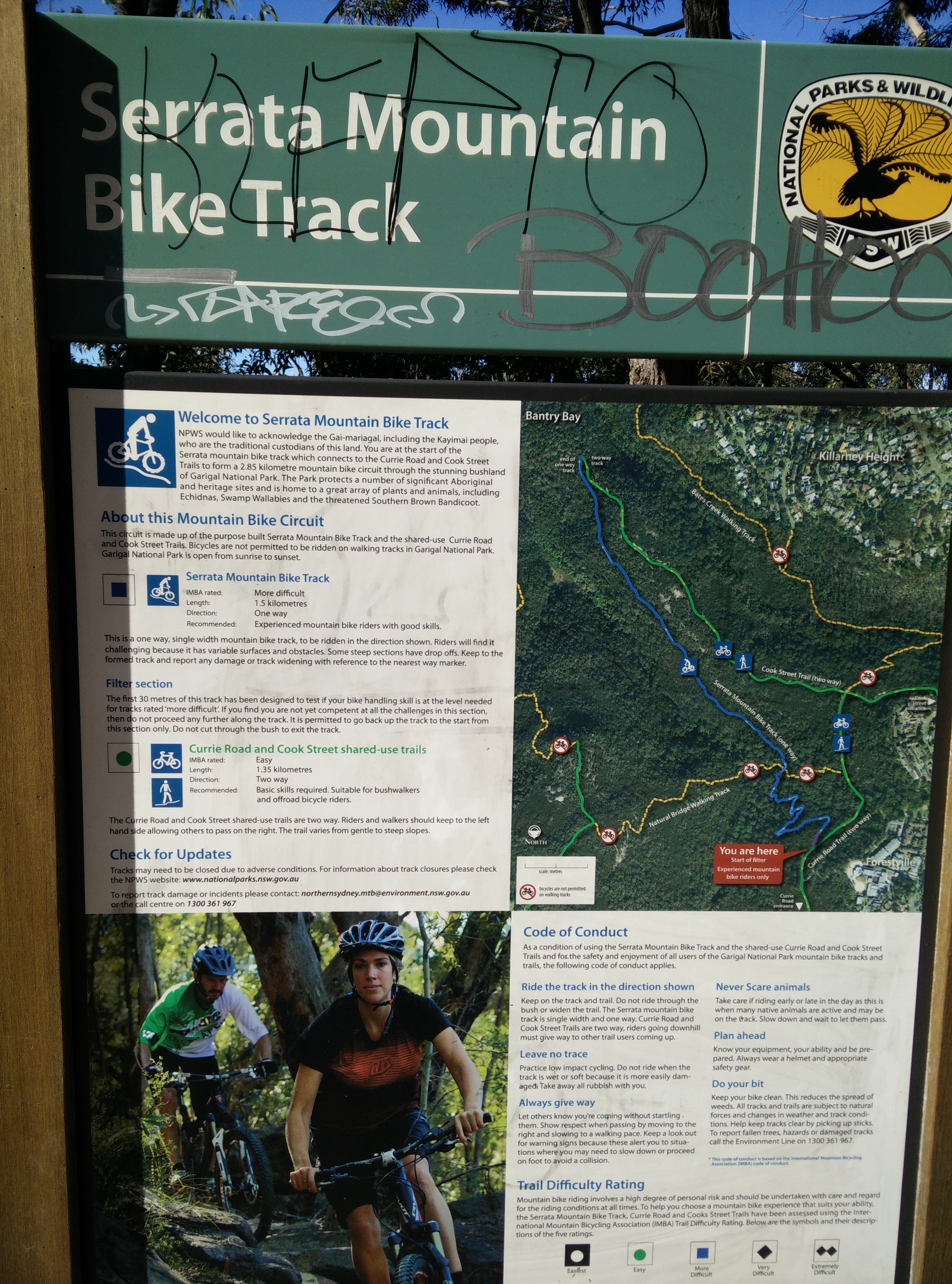
I have,
https://wiki.openstreetmap.org/w/images/9/96/Serrata_Mountain_Bike_Track_Board_Map.jpeg


> I see both mtb:scale and mtb:scale:imba both used.   The wiki for
> mtb:scale doesn't make sense.   It's either skewed for extremely extreme
> riding or they don't understand gradient.   It says that for mtb:scale=1,
> gradient<40%.   This is meaningless.   Nobody can ride up an unpaved grade
> that is 40%, or probably even 30%.   A steep trail is 15%.   A really
> steep, almost unrideable, very difficult hiking, trail is 20%.    Going
> downhill, anything above 25% is a double black, only a small percentage of
> riders can ride, unless it is very smooth with really good traction.
>

I agree, I find it very hard to set mtb:scale confidently based on the
descriptions on the wiki.

In my opinion, mtb:scale:imba could be deprecated, and the wiki for
> mtb:scale updated & clarified.
>

I would disagree on that, mtb:scale:imba is still useful to mark officially
signposted or designated ratings of the track made according to the IMBA
system, like in the first photo I posted.

I'd be very keen to review any improvements to mtb:scale though, I have
very low confidence in all the ones I've tagged so far as I feel like every
time I read the wiki I have a different opinion
_______________________________________________
Tagging mailing list
[email protected]
https://lists.openstreetmap.org/listinfo/tagging