On 11.04.19 23:28, Tobias Knerr wrote:
> A decent heuristic is to connect each node from the upper border to the
> closest point (not necessarily a node) on the lower border, and vice
> versa. Then you place steps at regular intervals along these connections.
>
> For common step shapes, this should produce the expected results. I
> might be able to cobble together a proof of concept over the next few
> days if that could help convince you?
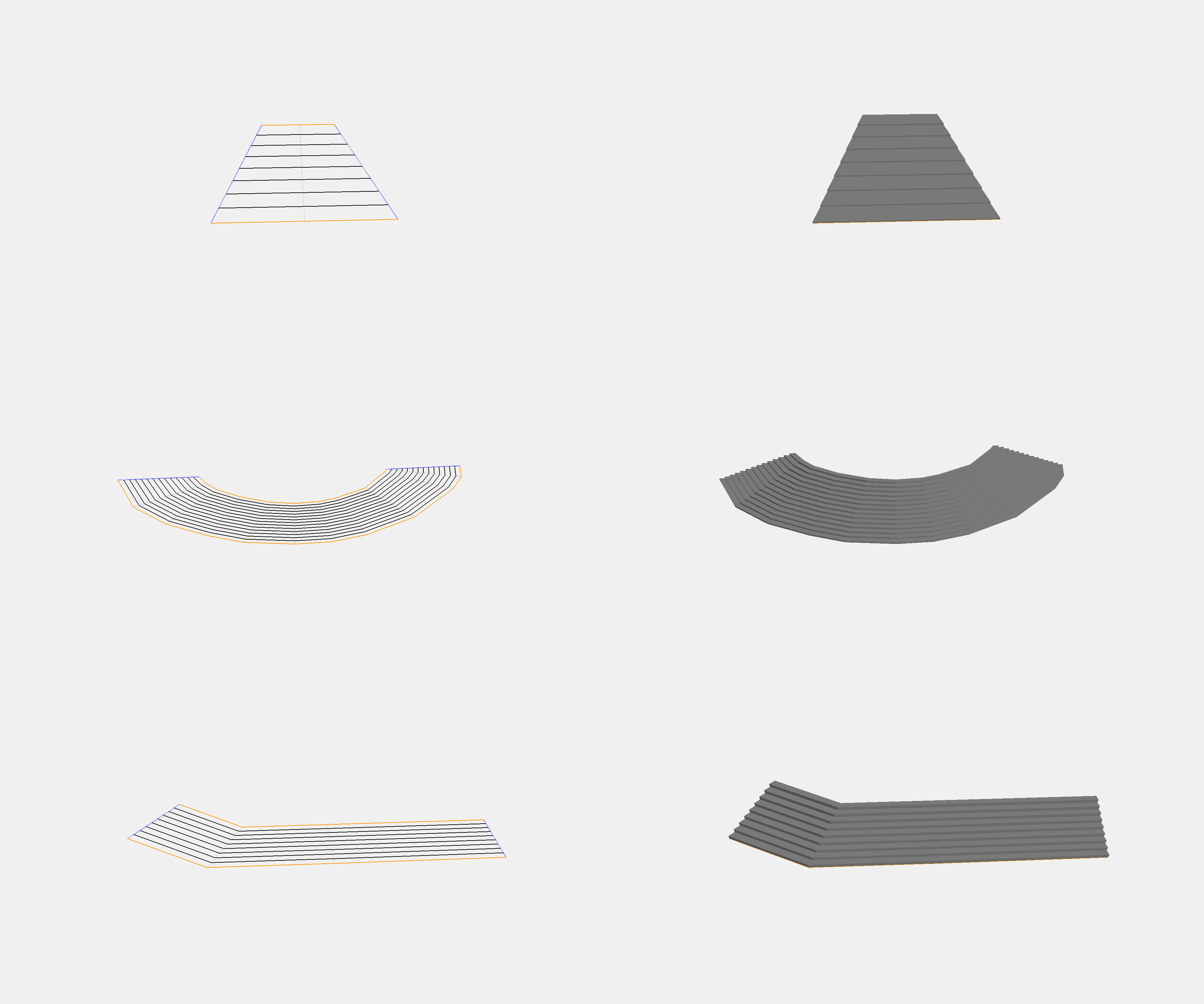
So I finally got around to building that prototype to test my idea. The
code only needs a highway=step way and an area:highway polygon as input,
and produces sensible results for common shapes of straight stairways.
I'm pretty happy with the results:

http://tobias-knerr.de/upload/Step%20Polygon%203D%20Examples.png

This image shows a few examples of steps with a basic 3d rendering
alongside a debug view that highlights the algorithm's internal view of
the data (in particular the automatic decomposition into left/right and
front/back parts of the outline, and the construction of the steps).

Tobias

_______________________________________________
Tagging mailing list
Tagging@openstreetmap.org
https://lists.openstreetmap.org/listinfo/tagging