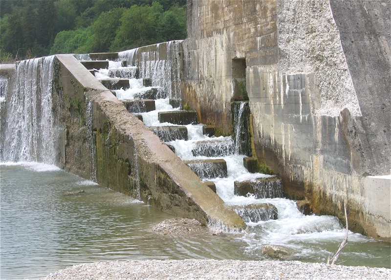
You'd be *very* surprised what shapes fish passes can take.
I don't think it's a good idea to use the waterway key to tell that whatever
feature is intended to be a fish pass.
This one, although man made is definitely a river, that was built as 1) a fish
pass, 2} a whitewater course.
https://www.openstreetmap.org/#map=17/45.84919/5.41420
Le 19 juillet 2018 10:43:23 GMT+02:00, Martin Koppenhoefer
<[email protected]> a écrit :
>
>
>sent from a phone
>
>> On 19. Jul 2018, at 10:22, Javier Sánchez Portero
><[email protected]> wrote:
>>
>> Could a fish pass look like a short and very narrow canal like the
>images in this pages?
>>
>> https://en.wikipedia.org/wiki/Levada
>> https://es.wikipedia.org/wiki/Acequia
>
>
>it is not so much about what it looks like, but about the purpose it
>was built for. Are fishes using those canals?
>
>Often (?) they might provide kind a steps so greater heights can be
>passed:
>http://www.htsbau.de/.cm4all/iproc.php/Button/FAH%20technisch.jpg/downsize_1280_0/FAH%20technisch.jpg
>
>http://de.academic.ru/pictures/dewiki/70/Fischtreppe_Isar_bei_Pullach.jpg
>
>wikipedia has a lot of examples as well:
>https://en.m.wikipedia.org/wiki/Fish_ladder
>
>Cheers,
>Martin
_______________________________________________
Tagging mailing list
[email protected]
https://lists.openstreetmap.org/listinfo/tagging