Thanks for clarifying Jo - I think this is all ok as long as we give users the
option to say whether they think their `amenity=shelter` is a building or not.
 For the bus shelters I could see it as either way but would not override a
local mapper’s choice.
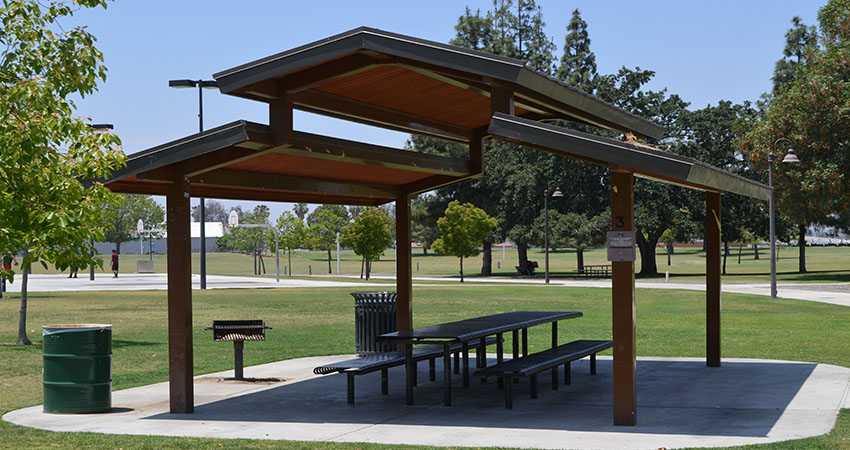
Maybe we should start a separate thread for “what is a `building=*` really”
because this is something I see frequent confusion over.

Thanks, Bryan


> On Jun 18, 2018, at 10:29 AM, Jo <[email protected]> wrote:
>
> shelter=yes on a highway=bus_stop NODE indicates there is a shelter nearby,
> but says nothing about where it is exactly nor its size.
>
> amenity=shelter
> shelter_type=public_transport
>
> on a CLOSEDWAY
>
> indicates where the shelter is. height is not super important. I guess most
> are about 2.3m high. If it is considered important I'll go out and measure
> one and start tagging that on them. But that still doesn't make them
> buildings. They are more like containers with glass wall panels and a metal
> roof on a slab of concrete. Relatively easy to move and relatively small in
> size.
>
> Polyglot
>
> Op ma 18 jun. 2018 om 15:28 schreef Bryan Housel <[email protected]
> <mailto:[email protected]>>:
>> There are also picnic shelters .. here they can have no walls just a roof to
>> shelter from the heat of the sun or the occasional bit of rain.
>> e.g.
>> https://www.riversideca.gov/park_rec/sites/riversideca.gov.park_rec/files/pictures/Picnic%20Shelter%20Hunter%20hobby.JPG
>>
>> <https://www.riversideca.gov/park_rec/sites/riversideca.gov.park_rec/files/pictures/Picnic%20Shelter%20Hunter%20hobby.JPG>
>>
>
> I would tag that as:
>
> amenity=shelter
> building=roof        ( <— this tag is really the point of the thread)
>
>
>>> The following three are no buildings from my point of view because they
>>> have one wall only. Either the two other walls do not fully stretch from
>>> the ground to the roof or the shelter itself can be removed easily.
>>>
>>> https://www.mapillary.com/app/?lat=49.08680549357706&lng=9.078079866007897&z=17&pKey=90pd5WuYg8zOk_L8dxLFFQ&focus=photo
>>>
>>> <https://www.mapillary.com/app/?lat=49.08680549357706&lng=9.078079866007897&z=17&pKey=90pd5WuYg8zOk_L8dxLFFQ&focus=photo>
>>> https://www.mapillary.com/app/?lat=49.08985722389377&lng=9.07931005221235&z=17&pKey=oXQHKqb3Lc3Ae9IXj-5PHw&focus=photo
>>>
>>> <https://www.mapillary.com/app/?lat=49.08985722389377&lng=9.07931005221235&z=17&pKey=oXQHKqb3Lc3Ae9IXj-5PHw&focus=photo>
>>> https://www.mapillary.com/app/?lat=49.10616167487336&lng=9.121348618135698&z=17&pKey=8xUGL_VKp45sOfd9VW7dUw&focus=photo
>>>
>>> <https://www.mapillary.com/app/?lat=49.10616167487336&lng=9.121348618135698&z=17&pKey=8xUGL_VKp45sOfd9VW7dUw&focus=photo>
> I would not use `amenity=shelter` at all and instead tag those as
> https://wiki.openstreetmap.org/wiki/Tag:highway=bus_stop
> <https://wiki.openstreetmap.org/wiki/Tag:highway=bus_stop>
>
> highway=bus_stop
> public_transport=platform
> bus=yes
> shelter=yes
> bench=yes
>
>
>>> There is building=roof but I would not use it for such shelters. They
>>> are not treated as buildings by the cadastre, why should I do? (If they
>>> are larger and have no walls, they
> Anything that should show up on a 3D map needs a `building` tag and maybe a
> `height`.
>
>>> I think that nobody of us knows the whole world and that's why I ask you
>>> not to decide on the default values of the whole world. If local mappers
>>> think that a shelter is a building, they will tag it as such. If they
>>> think that it does not qualify to be a building, they will not add the tag.
> In iD, the things we provide as presets, and how we render those things on
> the screen influence how people map.
>
> It sounds like from the discussion that we should not assume that shelters
> are buildings, and instead provide a field so that mappers can decide.  Once
> we provide this field, we can expect a lot of people to use it.  (I’m trying
> to engage the tagging list a lot more so that people feel consulted when I
> change things in iD.)
>
> Thanks, Bryan
>
>
>
> _______________________________________________
> Tagging mailing list
> [email protected] <mailto:[email protected]>
> https://lists.openstreetmap.org/listinfo/tagging
> <https://lists.openstreetmap.org/listinfo/tagging>
> _______________________________________________
> Tagging mailing list
> [email protected]
> https://lists.openstreetmap.org/listinfo/tagging
_______________________________________________
Tagging mailing list
[email protected]
https://lists.openstreetmap.org/listinfo/tagging