Hi,

I have add a  google drive link to the world MGRS. This should help.
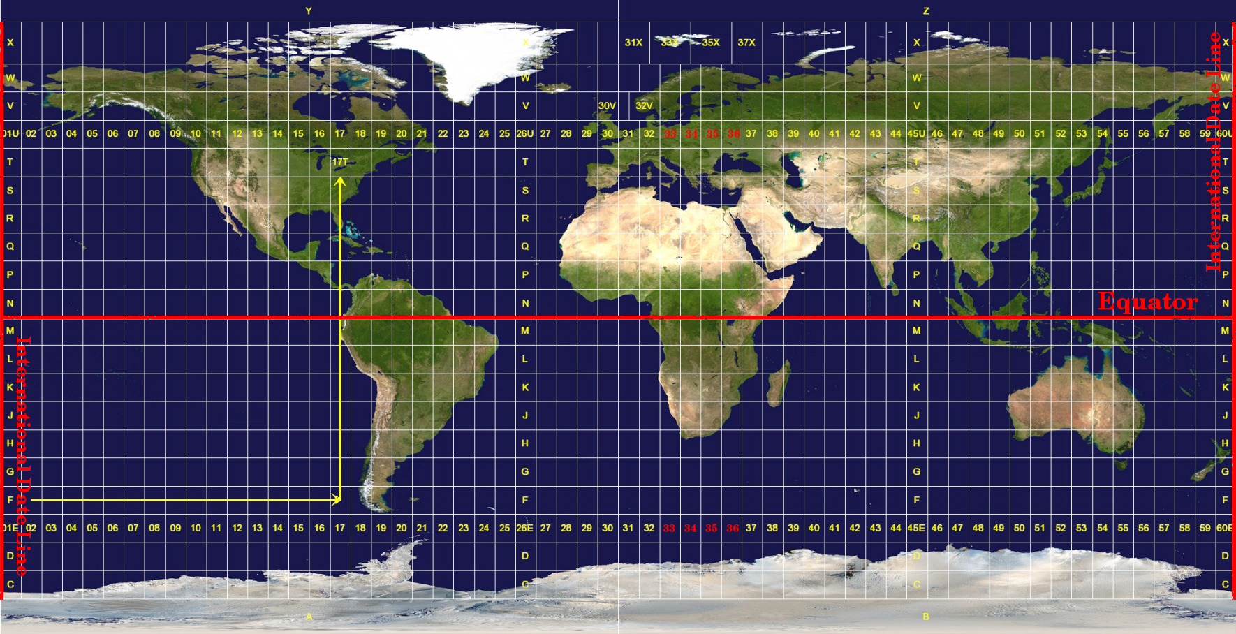
https://drive.google.com/file/d/1HeTOUCHrOF4dqLXyebO33nUwioYGnGbI/view?usp=sharing

Nicolas

On 2021-02-08 9:34 a.m., C Hamilton wrote:
I should have jumped in on this conversation over the weekend
especially since I am the author of Lat Lon Tools. but all who
responded have properly addressed the problems with UTM and
especially with how MGRS got mixed in with UTM and the confusion with
N & S. What Lat Lon Tools provides is the standard UTM coordinates
without the MGRS latitude bands. I have been considering adding
another function that provides the alternative UTM with MGRS latitude
bands.
If anyone has any suggestions on the best way to present these two
different UTM versions that helps to avoid ambiguity, please let me know.
Thanks,

Calvin
On Sat, Feb 6, 2021 at 2:19 PM Eric Sorensen <e....@me.com
<mailto:e....@me.com>> wrote:
    As Greg and others point out, I appear to be using the UTM zone
    term inappropriately.  My apologies.

    What I am after in my label, is the MGRS flavor that includes the
    latitude band, and agrees with the image shown in this link;

    https://docs.qgis.org/3.4/en/_images/utm_zones.png
    <https://docs.qgis.org/3.4/en/_images/utm_zones.png>

    After you folks successfully educated me on this, I came up with
    the following;

    concat(name, ', ',  mgrs_gzd($Y, $X), ' ', format_number(utm_east(
    $Y, $X), 0), ' ',  format_number(utm_north( $Y, $X), 0))

    Which gets me a label like this for the point I originally supplied;
    Park, 13S 384,258 3,974,547

    This is how my Garmin GPS displays coordinates of waypoints (sans
    the commas), and how someone would input the point into their gps,
    after I hand them a map I have created in QGIS.  Now to eliminate
    the commas.

    Thank you all for your input,
    es
    On Feb 6, 2021, at 11:41 AM, Greg Troxel <g...@lexort.com
    <mailto:g...@lexort.com>> wrote:


    Eric Sorensen <e....@me.com <mailto:e....@me.com>> writes:
     <wpt lat="35.908381976187229" lon="-106.282681999728084">
       <ele>2262.188964999999826</ele>
    The labels appear as expected, except one small problem.  I know
    the points are in UTM zone 13S, yet the label shows zone 13N.

    Any thoughts on what I am doing wrong.
    That latitude is north, and in New Mexico.  Why do you think it's
    zone
    13S?

    <pause to read>

    Beware of the confusion between grid zones from MGRS, not technically
    part of UTM, and UTM north/south.  See


https://en.wikipedia.org/wiki/Universal_Transverse_Mercator_coordinate_system#Notation

<https://en.wikipedia.org/wiki/Universal_Transverse_Mercator_coordinate_system#Notation>

    So it seems the UTM output uses S and N -- which is what I would
    expect
    for straight UTM without a MGRS flavor.

    If you moved north, you could be in 13T, from 40-48 degrees, and not
    have this issue, but then you'd have more snow :-)
    _______________________________________________
    Qgis-user mailing list
    Qgis-user@lists.osgeo.org <mailto:Qgis-user@lists.osgeo.org>
    List info: https://lists.osgeo.org/mailman/listinfo/qgis-user
    <https://lists.osgeo.org/mailman/listinfo/qgis-user>
    Unsubscribe: https://lists.osgeo.org/mailman/listinfo/qgis-user
    <https://lists.osgeo.org/mailman/listinfo/qgis-user>


_______________________________________________
Qgis-user mailing list
Qgis-user@lists.osgeo.org
List info: https://lists.osgeo.org/mailman/listinfo/qgis-user
Unsubscribe: https://lists.osgeo.org/mailman/listinfo/qgis-user
--
Nicolas Cadieux
https://gitlab.com/njacadieux
_______________________________________________
Qgis-user mailing list
Qgis-user@lists.osgeo.org
List info: https://lists.osgeo.org/mailman/listinfo/qgis-user
Unsubscribe: https://lists.osgeo.org/mailman/listinfo/qgis-user