Hi Tom

Any way you could post the two shapefiles somewhere?
I'd be interested to have a go at it (no promises here!!)
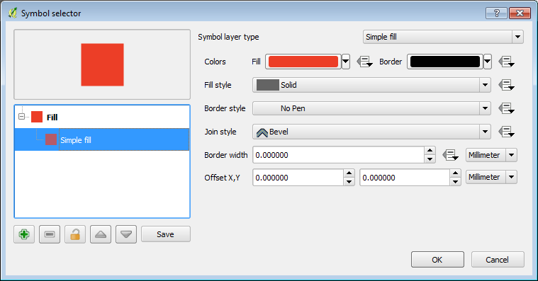
cheers
Peter

On Friday, 19 June 2015, <[email protected]> wrote:

> Send Qgis-user mailing list submissions to
>         [email protected] <javascript:;>
>
> To subscribe or unsubscribe via the World Wide Web, visit
>         http://lists.osgeo.org/mailman/listinfo/qgis-user
> or, via email, send a message with subject or body 'help' to
>         [email protected] <javascript:;>
>
> You can reach the person managing the list at
>         [email protected] <javascript:;>
>
> When replying, please edit your Subject line so it is more specific
> than "Re: Contents of Qgis-user digest..."
>
>
> Today's Topics:
>
>    1. Re: QGIS Composer: exported image doesn't have the        world file
>       (skampus)
>    2. WFS?and encoding issue (Andreas Neumann)
>    3. Merging Shapefiles on Top of Each Other (Tom Faro)
>    4. Question on Personal Geodatabase with QGIS 2.8.2 32 bit
>       (Randal Hale)
>    5. Re: QGIS Composer: exported image doesn't have    the     world file
>       (Micha Silver)
>    6. Naechster Nachbar Analyse (Carina Hausladen)
>    7. Icon for action (Bernhard Str?bl)
>    8. Fill symbol with no outline... showing faint outline?
>       (Chris Buckmaster)
>
>
> ----------------------------------------------------------------------
>
> Message: 1
> Date: Thu, 18 Jun 2015 02:58:57 -0700 (PDT)
> From: skampus <[email protected] <javascript:;>>
> To: [email protected] <javascript:;>
> Subject: Re: [Qgis-user] QGIS Composer: exported image doesn't have
>         the     world file
> Message-ID: <[email protected] <javascript:;>>
> Content-Type: text/plain; charset=us-ascii
>
> YESSSSSSSSSSSSSS, it works fine (as usual).
>
> sorry sorry sorry for the noise...
>
> grazie a tutti
>
> s.
>
>
>
>
>
> --
> View this message in context:
> http://osgeo-org.1560.x6.nabble.com/QGIS-Composer-exported-image-doesn-t-have-the-world-file-tp5211511p5211611.html
> Sent from the Quantum GIS - User mailing list archive at Nabble.com.
>
>
> ------------------------------
>
> Message: 2
> Date: Thu, 18 Jun 2015 12:07:36 +0200
> From: Andreas Neumann <[email protected] <javascript:;>>
> To: qgis-user <[email protected] <javascript:;>>
> Subject: [Qgis-user] WFS?and encoding issue
> Message-ID: <[email protected] <javascript:;>>
> Content-Type: text/plain; charset=utf-8; format=flowed
>
> Hi,
>
> I am trying to use this WFS: http://wms.zh.ch/NEKWMS
>
> I can access it fine, but many of the attributes display invalid german
> Umlauts. The WFS client dialogues does not allow me to specify an
> encoding. Is there a way to set the encoding for the WFS results?
>
> Or would I have to ask the WFS server administrator to do something
> about it?
>
> Thanks for any hints,
> Andreas
>
>
> ------------------------------
>
> Message: 3
> Date: Thu, 18 Jun 2015 10:59:47 +0000
> From: Tom Faro <[email protected] <javascript:;>>
> To: "[email protected] <javascript:;>" <[email protected]
> <javascript:;>>
> Subject: [Qgis-user] Merging Shapefiles on Top of Each Other
> Message-ID:
>         <[email protected]>
> Content-Type: text/plain; charset="utf-8"
>
> I have been having some trouble with merging two shapefiles - one is a map
> of all sectors in the UK and one is a map of all motorways in the UK. I
> have successfully merged them by putting them both as polygons. However,
> when I fill in the sectors with different colours the road map disappears.
> The same happens when I use the same shapefile in other software.
>
> Is it possible to merge them so that the roads are always on top? Any Help
> with this matter would be greatly appreciated.
>
> Many Thanks,
> Tom
>
> Please consider the environment before printing this e-mail.
>
> -------------------------------------------------------------------------------------
>
> Zenith Insurance Management UK Limited is an appointed service provider to
> Zenith Insurance plc and is not an Agent of Zenith Insurance plc.
> Zenith and Link are the European brands of the Markerstudy Group of
> Companies.
>
> Zenith Insurance Management UK Limited (Registered No. 5309111). Link
> Underwriting Agency Limited (Registered No. 4227586).
> Both companies are registered in England & Wales at Chester House,
> Harlands Road, Haywards Heath, West Sussex, RH16 1LR. Zenith Insurance
> Management UK Limited is authorised and regulated by the Financial Conduct
> Authority (No. 429279). For security and training purposes, all
> calls may be monitored or recorded.
>
> Any views of opinions expressed in this e-mail are solely those of the
> author and do not necessarily represent those of the Markerstudy
> Group of Companies. This message (and any attachments) contains
> information that may be confidential and protected from disclosure.
> If you are not the intended recipient of this message or any parts of it,
> please immediately contact the sender and delete the message
> from your system. No other person is authorised to copy, forward,
> distribute, disseminate or retain this message in any form.
>
>
> -------------------------------------------------------------------------------------
> This email message has been scanned for viruses by Mimecast.
> Mimecast delivers a complete managed email solution from a single web
> based platform.
> For more information please visit http://www.mimecast.com
>
> -------------------------------------------------------------------------------------
> -------------- next part --------------
> An HTML attachment was scrubbed...
> URL: <
> http://lists.osgeo.org/pipermail/qgis-user/attachments/20150618/fbcaf41a/attachment-0001.html
> >
> -------------- next part --------------
> A non-text attachment was scrubbed...
> Name: 115061812022907287.gif
> Type: image/gif
> Size: 1724 bytes
> Desc: not available
> URL: <
> http://lists.osgeo.org/pipermail/qgis-user/attachments/20150618/fbcaf41a/attachment-0001.gif
> >
>
> ------------------------------
>
> Message: 4
> Date: Thu, 18 Jun 2015 09:28:12 -0400
> From: Randal Hale <[email protected] <javascript:;>>
> To: "[email protected] <javascript:;>" <[email protected]
> <javascript:;>>
> Subject: [Qgis-user] Question on Personal Geodatabase with QGIS 2.8.2
>         32 bit
> Message-ID: <[email protected] <javascript:;>>
> Content-Type: text/plain; charset="utf-8"; Format="flowed"
>
> I've had a question and I'm not sure how to answer it. I've dug through
> bug reports and other "googling" for an answer.
>
> I've done this and It works - I have 0 problem:
> http://www.northrivergeographic.com/qgis-accessing-personal-geodatabase
>
> I received an email from from a gentleman who is running Windows
> Professional 64bit, QGIS 2.8.2 32 bit, Microsoft Office 32 bit - and he
> can't open Personal Geodatbases even after setting up an ODBC
> connection. Everything works up until the he opens it in QGIS - it
> doesn't see the Geometry. I'm assuming there is some weird and wild ODBC
> driver issue (mixing 32 and 64 bit somewhere). Is there a problem with
> QGIS 2.8.2 32 bit and personal geodatabases. I'm guessing the IT
> department had him keep everything 32 bit on his workstation. I see past
> reports but nothing current.
>
> Thoughts? Angst?
>
> Questions he's asked on GIS Stackexchange:
>
>
> http://gis.stackexchange.com/questions/151302/connecting-problem-odbc-versus-esri-personal-geodatabase-mdb
>
>
> http://gis.stackexchange.com/questions/151126/connect-to-an-esri-personal-geodatabase-mdb
>
> Randy
>
> --
> -----------------
> Randal Hale
> North River Geographic Systems, Inc
> http://www.northrivergeographic.com
> 423.653.3611 [email protected] <javascript:;>
> twitter:rjhale     http://about.me/rjhale
> http://www.northrivergeographic.com/introduction-to-quantum-gis
> Southeast OSGEO: http://wiki.osgeo.org/wiki/Southeast_US
>
> -------------- next part --------------
> An HTML attachment was scrubbed...
> URL: <
> http://lists.osgeo.org/pipermail/qgis-user/attachments/20150618/70894080/attachment-0001.html
> >
>
> ------------------------------
>
> Message: 5
> Date: Thu, 18 Jun 2015 16:40:23 +0300
> From: Micha Silver <[email protected] <javascript:;>>
> To: QGIS Mailing List <[email protected] <javascript:;>>
> Cc: skampus <[email protected] <javascript:;>>
> Subject: Re: [Qgis-user] QGIS Composer: exported image doesn't have
>         the     world file
> Message-ID: <[email protected] <javascript:;>>
> Content-Type: text/plain; charset="us-ascii"
>
> An HTML attachment was scrubbed...
> URL: <
> http://lists.osgeo.org/pipermail/qgis-user/attachments/20150618/6dcd1ee1/attachment-0001.html
> >
>
> ------------------------------
>
> Message: 6
> Date: Thu, 18 Jun 2015 17:28:34 +0200
> From: "Carina Hausladen" <[email protected] <javascript:;>>
> To: <[email protected] <javascript:;>>
> Subject: [Qgis-user] Naechster Nachbar Analyse
> Message-ID: <[email protected]
> <javascript:;>>
> Content-Type: text/plain; charset=UTF-8
>
> Hallo liebe Geowissenschaftler und Geowissenschaftlerinnen,
> ich habe zwei Fragen zu QGIS/ n?chste Nachbaranalyse und hoffe, dass
> mir jemand aus der Community weiterhelfen kann:
>
> 1. Ich habe einen Vektorlayer mit Koordinaten (ermittelt ?ber Google
> Maps) eingef?gt (verwendetes Koordinatensystem WGS 84). Ich m?chte
> allerdings den Abstand zum n?chsten Nachbarn in m. Wenn ich ?DHDN Gauss
> Krueger Zone 3? als Eingabeoption verwende, werden keine Punkte
> angezeigt. Wie erhalte ich also den Abstand in m?
>
> 2. Die Analyse gibt drei Werte aus ?Beobachteter mittlerer Abstand?,
> ?Erwarteter mittlerer Abstand? und ?N?chster Nachbarindex?. Wei?
> jemand, wie genau diese Werte berechnet werden?
>
> Ich freue mich auf eure Antworten, vielen Dank!
> Beste Gr??e
> Carina
>
>
> ------------------------------
>
> Message: 7
> Date: Thu, 18 Jun 2015 17:53:46 +0200
> From: Bernhard Str?bl <[email protected] <javascript:;>>
> To: [email protected] <javascript:;>
> Subject: [Qgis-user] Icon for action
> Message-ID: <[email protected] <javascript:;>>
> Content-Type: text/plain; charset=utf-8; format=flowed
>
> Hi all,
>
> QGIS 2.8 (if I am not mistaken) introduced the option to define an icon
> for an action. No matter what image I use (png/svg) the icon is
> displayed in the list of actions in layer properties but QGIS' UI still
> displays the standard action icon.
> I thought I could mark my actions with different icons in the UI. Am I
> doing something wrong or is this not possible?
>
> thanks
>
> Bernhard
>
>
> __________ Information from ESET Mail Security, version of virus signature
> database 11807 (20150618) __________
>
> The message was checked by ESET Mail Security.
> http://www.eset.com
>
>
>
>
> ------------------------------
>
> Message: 8
> Date: Thu, 18 Jun 2015 16:06:47 +0000
> From: Chris Buckmaster <[email protected] <javascript:;>>
> To: "[email protected] <javascript:;>" <[email protected]
> <javascript:;>>
> Subject: [Qgis-user] Fill symbol with no outline... showing faint
>         outline?
> Message-ID:
>         <
> 0ae8eab40c6d4d439cc65cf2257093a07303d...@rbcex01.civicoffices.runnymede.gov.uk
> <javascript:;>>
>
> Content-Type: text/plain; charset="us-ascii"
>
> Hi
>
> I am symbolising up my polygon layer which has multiple features with a
> simple red fill, no outline and a 40% layer transparency. When looking at
> the map though I am seeing faint white lines which represent the different
> features. I am wondering what I need to do to remove these white lines as I
> am not specifying an outline for the features?
>
> Thanks
>
> [cid:[email protected]]
> [cid:[email protected]]
> -------------- next part --------------
> An HTML attachment was scrubbed...
> URL: <
> http://lists.osgeo.org/pipermail/qgis-user/attachments/20150618/cd0883f3/attachment.html
> >
> -------------- next part --------------
> A non-text attachment was scrubbed...
> Name: image001.png
> Type: image/png
> Size: 28922 bytes
> Desc: image001.png
> URL: <
> http://lists.osgeo.org/pipermail/qgis-user/attachments/20150618/cd0883f3/attachment.png
> >
> -------------- next part --------------
> A non-text attachment was scrubbed...
> Name: image002.png
> Type: image/png
> Size: 12906 bytes
> Desc: image002.png
> URL: <
> http://lists.osgeo.org/pipermail/qgis-user/attachments/20150618/cd0883f3/attachment-0001.png
> >
>
> ------------------------------
>
> _______________________________________________
> Qgis-user mailing list
> [email protected] <javascript:;>
> http://lists.osgeo.org/mailman/listinfo/qgis-user
>
> End of Qgis-user Digest, Vol 112, Issue 44
> ******************************************
>


--
Peter Borbély
<[email protected]>
Interactivista
Fairfax Media
1 Darling Island Road, Pyrmont 2009
+61 2 8596 4745

[email protected] | @datafunk <http://twitter.com/datafunk>

--
The information contained in this e-mail message and any accompanying files
is or may be confidential. If you are not the intended recipient, any use,
dissemination, reliance, forwarding, printing or copying of this e-mail or
any attached files is unauthorised. This e-mail is subject to copyright. No
part of it should be reproduced, adapted or communicated without the
written consent of the copyright owner. If you have received this e-mail in
error please advise the sender immediately by return e-mail or telephone
and delete all copies. Fairfax Media does not guarantee the accuracy or
completeness of any information contained in this e-mail or attached files.
Internet communications are not secure, therefore Fairfax Media does not
accept legal responsibility for the contents of this message or attached
files.
_______________________________________________
Qgis-user mailing list
[email protected]
http://lists.osgeo.org/mailman/listinfo/qgis-user