Dear colleagues,

We are needing a colour map of the Silk Road route for the following:
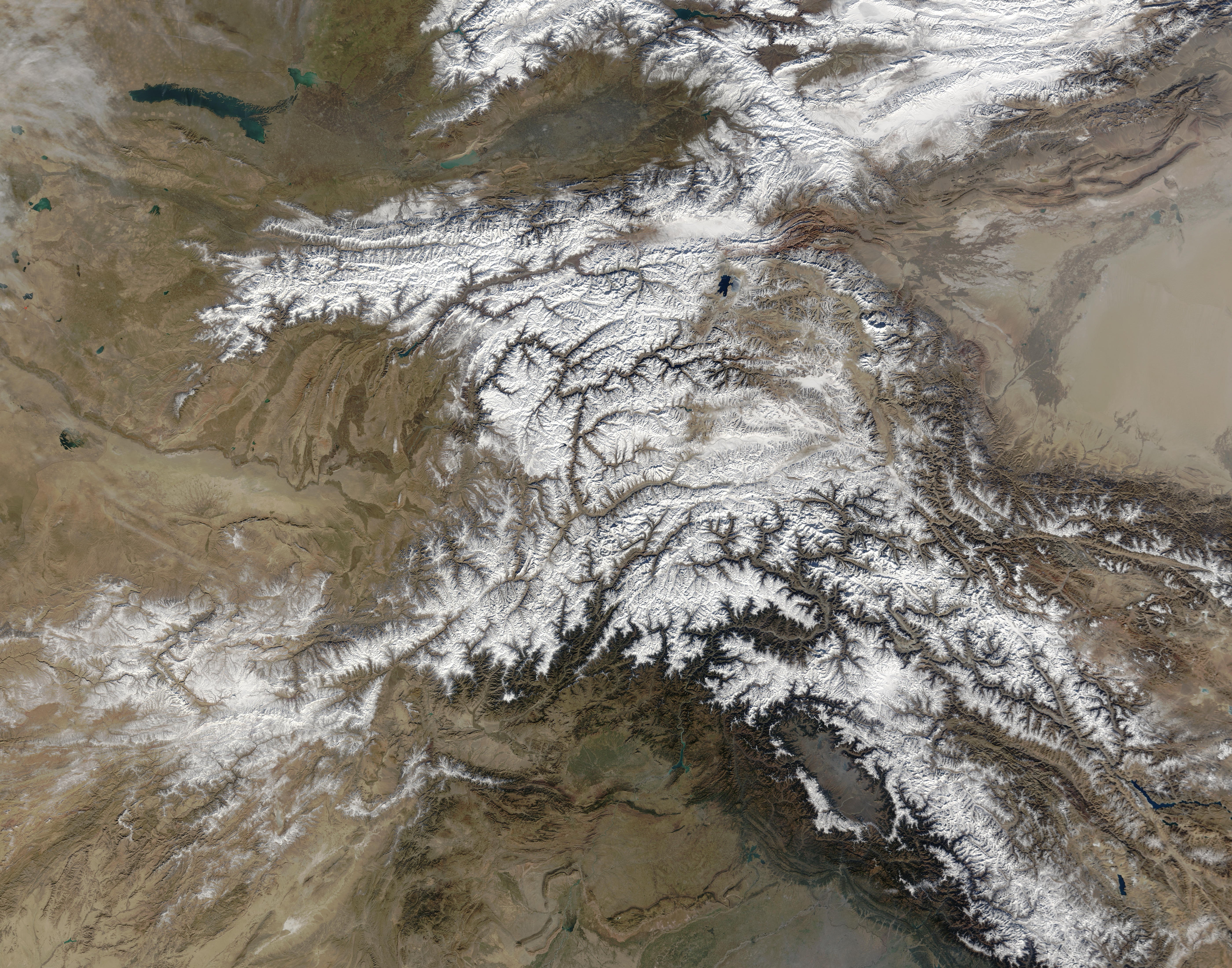
Sander, Lore & Dietz, Siglinde (forthcoming) Āṭānāṭīya-
and Āṭānāṭikasūtra:
Sūtra for protecting monks and nuns in the wilderness. Oxford: Indica
et Buddhica.

https://indica-et-buddhica.org/publications/sander-lore-dietz-siglinde/atanatiya-and-atanatikasutra


The coverage should be roughly equivalent to these two images
combined:

Winter and Summer in the Tarim Basin
https://visibleearth.nasa.gov/images/51678/winter-and-summer-in-the-tarim-basin/51678f

https://eoimages.gsfc.nasa.gov/images/imagerecords/51000/51678/tarim_tmo_2011218_lrg.jpg

The Hindu Kush
https://visibleearth.nasa.gov/images/69524/the-hindu-kush/69526l

https://eoimages.gsfc.nasa.gov/images/imagerecords/69000/69524/Tajikistan.A2003332.0610.250m.jpg


We would prefer not to use one of Stein's maps:

Stein, M. A. (1921) Serindia: detailed report of explorations in
Central Asia
and westernmost China / Aurel Stein; descriptive lists of antiques by
F.H. Andrews ... [et al.], v. 5: Maps. Oxford: Clarendon.


The IDP site has been checked for an alternative but "Map Search" does
not
seem to be currently available.

http://idp.bl.uk/maps/map_search.a4d


Does anyone know of a map that might be suitable?


Best, Richard


--
T +6433121699  M +64210640216
[email protected]
https://indica-et-buddhica.org/

Indica et Buddhica
Littledene  Bay Road  Oxford  NZ
_______________________________________________
INDOLOGY mailing list
[email protected]
https://list.indology.info/mailman/listinfo/indology